“GEGHARD”
SCIENTIFIC ANALYTICAL
FOUNDATION


2026
2026
2026-02-16
Shahkert was one of the notable Armenian settlements in the Ernjak district of the Syunik province of Greater Armenia, with the first mention of it dating to the 13th century. According to the renowned Armenian historian Stepanos Orbelian, the village paid an annual tax of eight dahekans to Tatev Monastery.[1]
It is known that since the Middle Ages, alongside Armenian place names, foreign names were also used, which sometimes also indicated crafts. Place names of this kind mainly ended with the Turkic suffix “chi”.[2] Shahkert was also known as Ghazanchi, which meant “village of cauldron-makers.”[3]
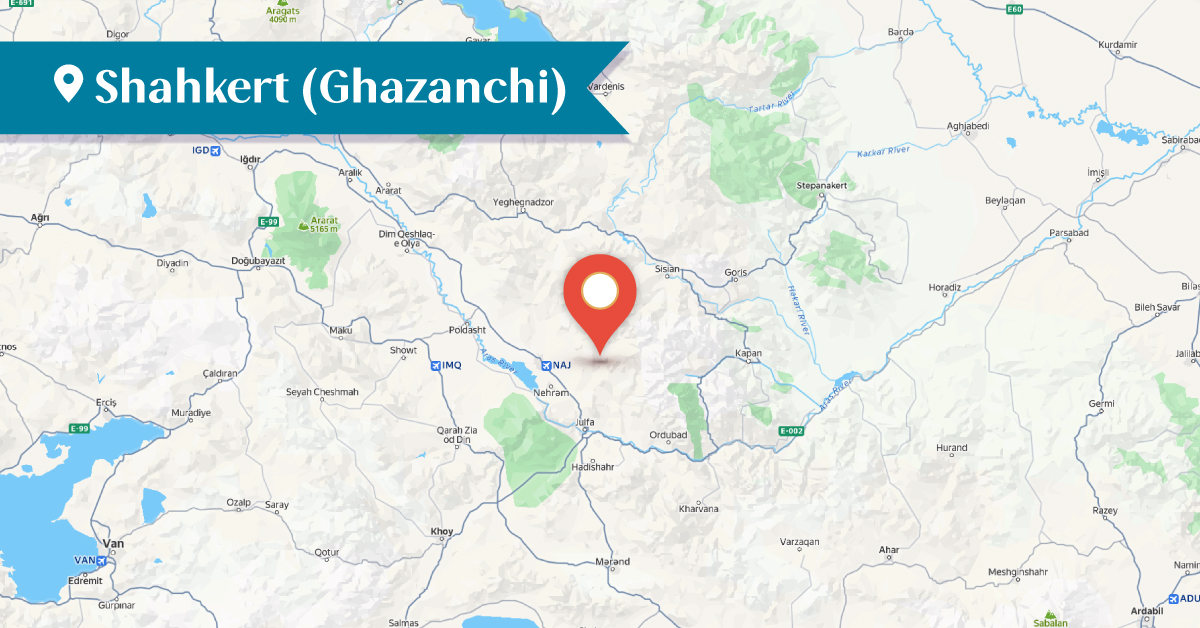
The village is located on the right bank of the Ernjak River, in a fertile and flat area. Until 1919, the inhabitants were exclusively Armenians. After the Russo-Persian War of 1826–1828, in 1828–1829, many Armenian families migrated here from Salmas. In 1915-1918, the village had a population of about 400 Armenian households.[4] Due to its large population, Shahkert was sometimes referred to as a town rather than a village.
In the 13th-17th centuries, copperwork was widespread among the Shahkert residents (hence the name Ghazanchi, which means “kettle-maker”).
According to sources, the village had 1,500 houses and 42 watermills.[5] However, from the second half of the 19th century, the main occupations of the village's inhabitants were agriculture, sericulture, and beekeeping. Locals link the origin of the name Shahkert with a legend according to which the Shah of Persia entered the village, and the villagers therefore named it first “Shah girdi” (meaning “the Shah came in”), and then it was transformed into Shahkert.[6]
According to another folk etymology, the village’s name is not related to copperwork, but rather to the word “gazanchi, kazanci,” which means “to judge, to earn.”[7]
In 1749–1750, the village of Shahkert, under the leadership of Hovhannes Khandamirian, rebelled against the Heydar-Quli Khan of Nakhijevan In these battles, the Shahkert residents used cannons they had cast themselves. Ultimately, the rebellion was suppressed, and the residents of Shahkert fled to Kapan.[8] To avoid the revenge of Heydar-Quli Khan, the residents of the village of later migrated to Artsakh, to Shushi, where they formed the Ghazanchetsots quarter. It was here that the Ghazanchetsots Cathedral of the Holy Savior was built between 1868 and 1887, and its opening took place on September 20, 1888.[9]
In Shahkert, a state (Russian) school was opened in 1897.[10]
Notable natives of Shahkert included the prominent Armenian Catholicos of the 16th century, Azaria of Jugha[11], princes Hovhannes and Vardazar Khandamiryan, the military commander Ghazanchetsi Ghazar, the wealthy merchants and philanthropists Markos and Zahrap Tarumyan[12], who settled in Shushi, and others.
During the Soviet era, Armenians and Azerbaijanis lived in the village. However, after 1974, Armenians no longer lived here.[13] The village's territory is rich in historical and cultural monuments, but most of them are currently in ruins.
In the central part of Shahkert is the Surb Amenaprkich (Holy Savior) Monastery, which was built in the 12th–13th centuries and renovated in 1654. The entrances are on the western, northern, and southern facades. The western facade has inscriptions, and the entrances are framed with decorative carvings. The monastery was still standing in the early 1990s.
The Church of Surb Hovhannes of Shahkert was built in the 12th–13th centuries. It was located in the southeastern part of the village, with its entrance on the west facade. It had no frescoes, iconography, or decorative carvings. The church is currently in a ruined state.
The Shahkert Bridge was built in 1551 on the Ernjak River by Father Poghos of Ghazanchetsi, and it is still in use today.
The old cemetry is located in the northeastern part of the village, which dates back to the 10th–18th centuries. Some 700–720 tombstones have been preserved, 236 of which are inscribed.[14]
The new cemetery is located in the southwestern part of the village and dates back to the 18th–20th centuries. It contains 400–410 tombstones, of which 270–275 are inscribed. Some of the inscriptions dating from the 18th–19th centuries are deteriorated.[15] Another cemetery, dating to the 17th–20th centuries, is located on the northern side of the village. It contains 71 tombstones, of which 23 are inscribed.[16]
The Shahkert Fortress was built in the 10th-12th centuries, on the pointed northern peak of the mountain near the village. It was constructed by the Armenian princes of the Syunik region and the Ernjak district. In the 18th century, the fortress was rebuilt by the prominent Shahkert noble, Hovhannes Khandamiryan. The inner fortress was located in an inaccessible spot at the mountain’s summit, with stone walls and towers. Today, the fortress remains in a ruined state.
The Shahkert caravanserai (inn) was located in the northeastern quarter of the village, which was built in the 16th–17th centuries; it is now ruined.
Shahkert village is currently located in the Julfa district of the Nakhijevan Autonomous Republic and is inhabited by Azerbaijanis.[17]
Bibliography
M. Chamchyants, History of the Armenians, vol. 3, Yerevan, 1984.
Ghevond Alishan, Sisakan, Venice, 1893.
Stepanos Orbelian, History of Syunik, Yerevan, 1986.
Arakel of Tabriz, History, Yerevan, 1988.
M. Barkhudaryan, Artsakh, Baku, 1895.
M. Barkhudaryan, Artsakh, Yerevan, 2019.
Persian documents of the Matenadaran: III – Shari’a notarial documents (17th–18th centuries), Yerevan, 2018․
T. Kh. Hakobyan, St. T. Melik-Bakhshyan, H. Kh. Barseghyan, Dictionary of Toponyms of Armenia and Adjacent Regions, Vol. 3, list 1, Yerevan, 1991.
T. Kh. Hakobyan, St. T. Melik-Bakhshyan, H. Kh. Barseghyan, Dictionary of Toponyms of Armenia and Adjacent Regions, Vol. 4, list 1, Yerevan, 1998.
A. Ayvazyan, The Armenian Monuments of the Nakhijevan ASSR: A Comprehensive List, Yerevan, 1986․
Nakhijevan Atlas, Research on Armenian Architecture Foundation, Yerevan, 2012․
V. Balayan, Shushi, Yerevan, 2017.
[1] Stepanos Orbelian, History of Syunik, Yerevan, 1986, p. 403
[2] Persian documents of the Matenadaran: III – Shari’a notarial documents (17th–18th centuries), Yerevan, 2018, p. 49.
[3] Ghevond Alishan, Sisakan, Venice, 1893, p. 362.
[4] Dictionary of Toponyms of Armenia and Adjacent Regions, Vol. 3, list 1, Yerevan, 1991, pp. 497-498.
[5] Ghevond Alishan, Sisakan, Venice, 1893, p. 362.
[6] Ibid.
[7] Dictionary of Toponyms of Armenia and Adjacent Regions, Vol. 4, list 1, Yerevan, 1998, pp. 56-57.
[8] M. Chamchyants, History of the Armenians, vol. 3, Yerevan, 1984, pp. 842-848.
[9] M. Barkhudaryan, Artsakh, Baku, 1895, p. 138, also M. Barkhudaryan, Artsakh, Yerevan, 2019, p. 138.
[10] Nakhijevan Atlas, 2012, p․ 23.
[11] Arakel of Tabriz, History, Yerevan, 1988, p. 278.
[12] V. Balayan, Shushi, Yerevan, 2017, p. 146.
[13] Dictionary of Toponyms of Armenia and Adjacent Regions, Vol. 4, list 1, Yerevan, 1998, pp. 56-57.
[14] A. Ayvazyan, The Armenian Monuments of the Nakhijevan ASSR: A Comprehensive List, Yerevan, 1986, p. 73.
[15] Ibid. p. 74
[16] Ibid.
[17] Now Shahkert is called Qazanci։