
“GEGHARD”
SCIENTIFIC ANALYTICAL
FOUNDATION


2026
2026
2026-11-09
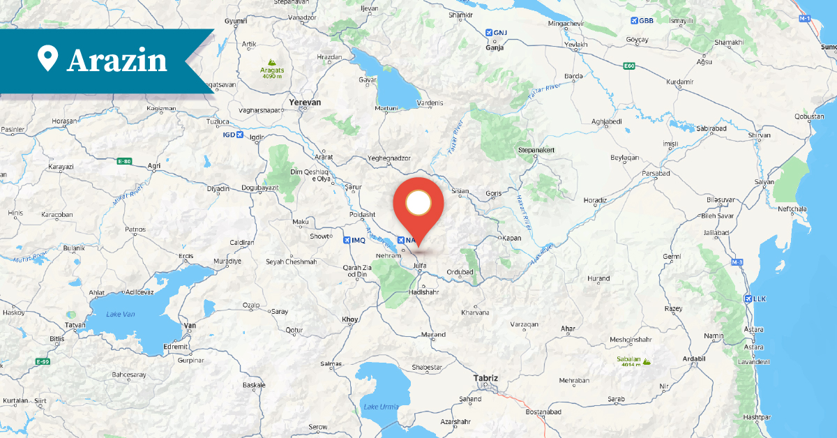
The village of Arazin was one of the Armenian villages of the Yerjnak district in the historical province of Syunik in Historical Armenia. It is located on the right bank of the lower reaches of the Yerjnak River, which flows through the territory of the Nakhijevan Autonomous Republic, 3–4 km east of the renowned village of Kznut, along the Nakhichevan–Julfa highway.
The area has been inhabited since ancient times. This is evidenced by the results of archaeological excavations conducted in the village during the 1970s, which uncovered archaeological materials and a cultural layer dating back to the first millennium BC.[1]
Previously, the village was part of the Nakhijevan district of the Yerevan Governorate. A significant proportion of the ancestors of the Armenians living in the village had migrated there from the districts of Sovuj Bulagh and Mahabad in Persia between 1829 and 1831.[2]
Between 1829 and 1832, the village was predominantly Armenian, with 290 households and 376 Armenian inhabitants.
From the mid-19th century onwards, a Muslim population settled in the village. As a result, during the 1860s, the Armenian population of Arazin moved from the old village to a location 1 km to the northwest, where they established a separate Armenian quarter known as Haytagh (the Armenian Quarter).[3] In 1873, the village had 70 households and 450 Armenian inhabitants. By the late 19th century, approximately 30 Armenian households remained there.
19th-century sources mention that Arazin had eight watermills, a small church, and other monuments, of which only insignificant traces have survived to the present day. The village's Church of St. Poghos-Petros (Paul-Peter) is dated in some sources to the 19th century, while others suggest an earlier origin. It was a small structure and is now in ruins, with only scant remains preserved. Near the village there is a burial ground consisting of tumulus-shaped tombs.
The village had a small church.[4] According to statistical data from 1906, the Armenian population of the village had reached 693.[5] In 1912, a state (Russian) school operated in the village.[6] In 1914, both Armenians and Muslims lived there.[7]
[1] A.Ayvazyan, The Armenian Monuments of the Nakhijevan ASSR: A Comprehensive List, Yerevan, 1986, p. 97.
[2] Dictionary of Toponyms of Armenia and Adjacent Regions, Vol. 1, list 1, Yerevan, 1986, p. 382.
[3] A. Ayvazyan, Nakhijevan: An Illustrated Encyclopedic Guide, Yerevan, 1995, pp. 104-105.
[4] Ghevond Alishan, Sisakan, Venice, 1893, p. 381.
[5] Dictionary of Toponyms of Armenia and Adjacent Regions, Vol. 1, list 1, Yerevan, 1986, p. 382.
[6] Nakhijevan Atlas, Research on Armenian Architecture Foundation, Yerevan, 2012, p. 23.
[7] Ibid p. 21։